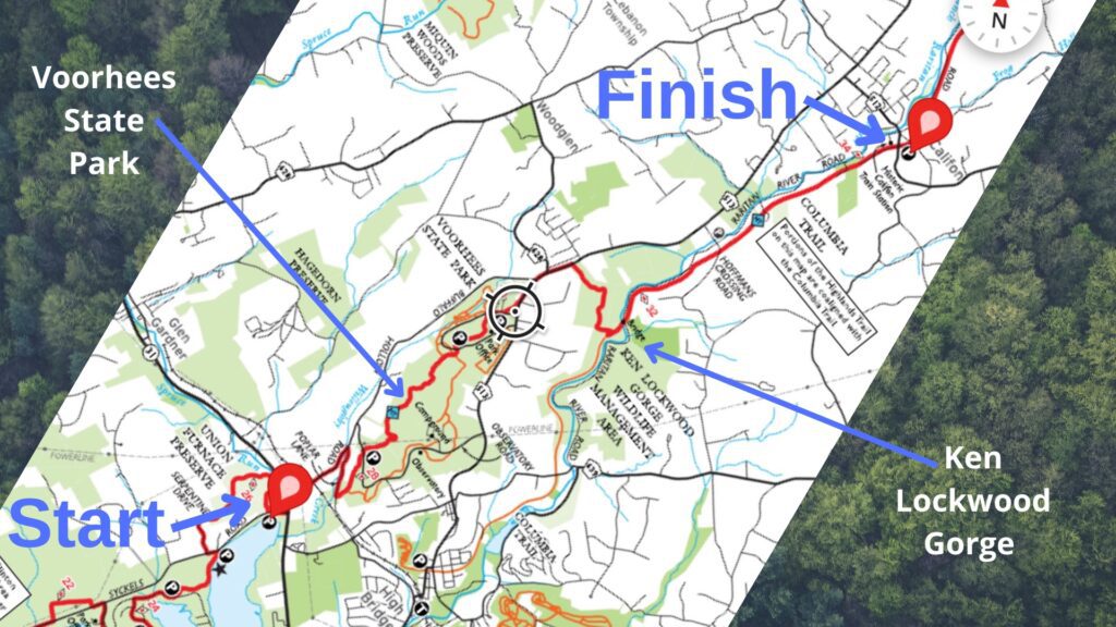
NJ Highlands Trail – Hike 4 began at the Spruce Run Parking Area near Rt. 31. This is a perfect beginning or end spot for a hike on the Highlands Trail as there is ample parking, it is near a highway, and you get nice views of Spruce Run Creek and Reservoir.
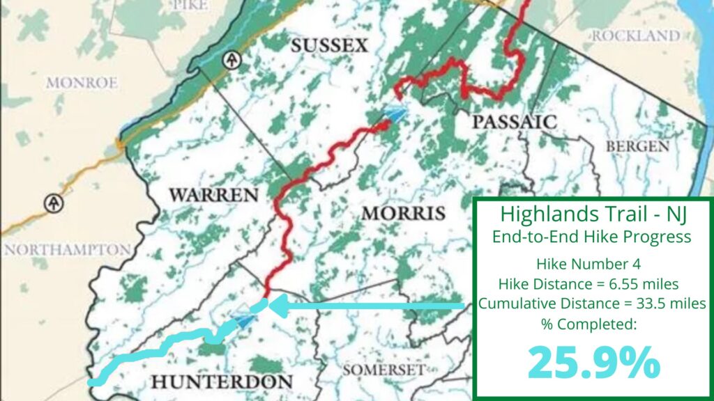
The Highlands Trail begins at the Delaware River in the South and continues to the Hudson River in the North. The Highlands Trail is about 170 miles in length with over 120 miles within New Jersey’s boundaries. Below you will find key facts, details, and a map of this section of the Highlands Trail in New Jersey.
Key Facts: NJ Highlands Trail – Hike 4
Mileage and time
6.55+ miles from the Spruce Run Parking Area (near the intersection of Rt. 31 and Van Syckel Rd.) to the former rail station in Califon, NJ. With side trails and diversions, my hike was a little longer at 8.3 miles to Califon. This hike lasted 3 hours and 15 minutes, including a few breaks (23:49 pace per mile).
Actually, I miscommunicated about my pick-up this day and ended up hiking back to my car. I hiked through the Ken Lockwood Gorge and on roads to shorten the return journey which made the total hike just about 13 miles.
Rating
Mostly easy hiking. There are a few hills to climb and a rocky section here and there but this is a hike almost anyone could do. The final section of this hike joins the Columbia Trail (Rails-to-Trails) which is very easy walking.
Notable trail sections
Spruce Run Recreation Area, Voorhees State Park, South Branch Wildlife Management Area, Columbia Trail, and a former Rail Station in Califon.
Road walking
Road walking on this section is almost all in the beginning. From the Spruce Run Parking Area, you cross Rt. 31 and head north. Fortunately, there is a traffic light and pedestrian path to cross. Make a quick right on Buffalo Hollow Rd. and then another right on Poplar Rd. before the trail heads into Voorhees State Park.
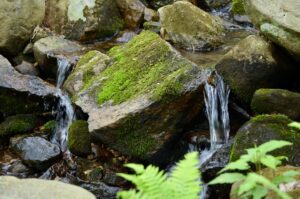
Both Buffalo Hollow and Poplar Roads are scenic and have nearby streams that are nice to hear and see. The only other road section is a brief walk on Rt. 513 in between Voorhees State Park and the South Branch Wildlife Management Area.
It can take decades to move a long-distance hiking trail mostly off roads and folks are actively planning and relocating the trail a step at a time. One way to help the Highlands Trail is to join the NY/NJ Trail Conference by visiting their website.
NJ Highlands Trail – Hike 4 Trail Map
Family Friendly
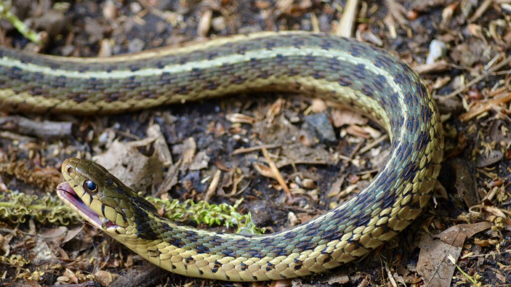
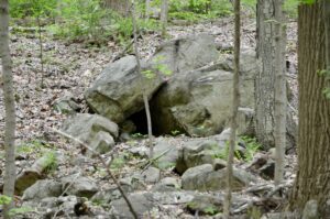
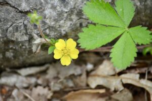
This is a very manageable hike for all ages. The only areas of concern are crossing Rt. 31 and Rt. 513. The hike had plenty to keep the attention of children (and adults) including wildlife, creeks, a small cave, flowers in spring, and beautiful forested areas.
Trail Parking
The Spruce Run Parking Area by Rt. 31 almost always has spaces available and there is parking in Califon just north of the former rail station. Additionally, parking is an option in Voorhees State Park or the Ken Lockwood Gorge if you want to shorten this section hike.
Trail Tips
- Wear comfortable, waterproof hiking shoes, especially in Spring. There are a few creek crossings and wet areas but required high-cut boots.
- Rt. 31 has a traffic light and pedestrian path to cross. Rt. 513 has neither so take your time and look both ways!
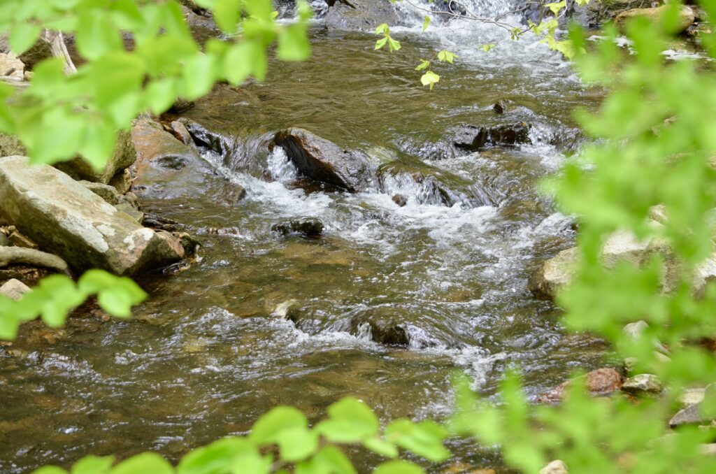
- Don’t write off the road section in the beginning. Willoughby Brook passes under Buffalo Hollow Rd. and runs next to Poplar Rd. and is super nice to see.
- If you are looking for a shorter hike or want to avoid road sections, then park at Voorhees State Park or Ken Lockwood Gorge and do out-and-back hikes that cover the Highlands Trail sections in those places. Both have other nice trails to add to your hike as well.
Begin near Rt. 31 for NJ Highlands Trail – Hike 4
NJ Highlands Trail, Hike 4 begins at the Spruce Run Parking Area by Rt. 31. Just south of this parking area are really nice sections of the Highlands Trail in the Union Furnace Nature Area and with Spruce Run Recreation Area. Both of these trail sections are covered in NJ Highland Trail – Hike 3 which includes pictures and video.
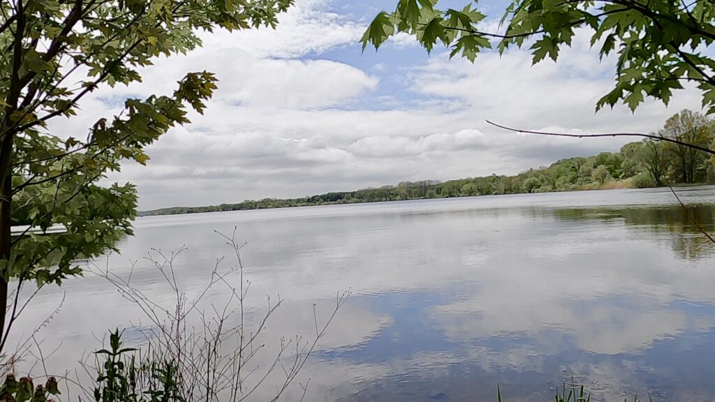
After parking, I took a short walk to Spruce Run Creek and then out on a small peninsula to get a view of the reservoir. After taking a few minutes to enjoy Spruce Run, I exited the parking area, made a right on Van Syckle Rd. and crossed Rt. 31. After pressing the walk button for the traffic light, I waited for the sign to tell me when to cross. Even though there is a painted pedestrian walk path, be sure to look both ways…twice!
NJ Highlands Trail – Hike 4: A Short Road Walk to Start
Turn right onto Buffalo Hollow Rd after walking on the grass in front of the Toyota Dealer. When I have our cars serviced here in the future, I will be sure to grab a seat facing the road while waiting. Maybe I will see a Highlands Trail section hiker passing by.
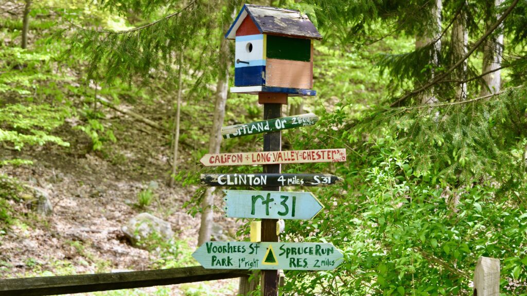
After an incline on Buffalo Hollow Rd., you will cross over Willoughby Brook. I stopped at the brook for a few minutes before turning right on Poplar Rd. As with almost all of the Highlands Trail so far, trail blazes were easy to follow. Be sure to look for the unique crossing sign at the intersection of Buffalo Hollow and Poplar (see below).
It is easy to forget that you are walking on the pavement while on Poplar Rd. You will be surrounded by trees and hear Willoughby Brook off to your right. Walking past an occasional house and knowing that you don’t have to look down for rocks or roots is all that makes this road walking. Before too long, the trail veers into the woods as you enter the Voorhees State Park section of the Highlands Trail in NJ.
Voorhees State Park
I had visited Voorhees State Park several times in the past. Because I had never hiked much here, I had been looking forward to this section of the Highlands Trail. Voorhees State Park didn’t disappoint and will be a future hiking destination so that I can trek on its other side trails.
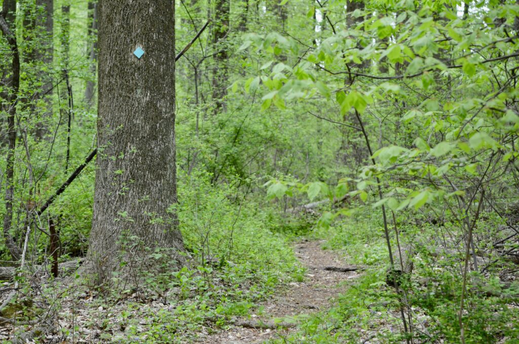
The Highlands Trail winds its way through Voorhees State Park starting from Poplar Rd. There are some small uphill sections and the trails changes from rocky to smooth to slightly wet sections. There are several intersecting trails in the park which means that future hikes here are all but certain.
This park was mostly forest and had streams, flowers, and wildlife all to take in. Eventually, the Highlands Trail crosses a road in the middle of the park where there is a Porto-Potty, park benches, and even playground equipment. There is another short trek through the woods before coming to a playground area, a pond, and Rt. 513. This is where you will exit Voorhees State Park for a short walk on Rt. 513.
South Branch Wildlife Management Area
NJ Highlands Trail – Hike 4 exits Voorhees State Park and follows Rt. 513 for a short distance. Be careful crossing this road when the trail heads into the woods at the South Brand Wildlife Management Area. I had driven on Rt. 513 in this area many times and always wondered where the trail went into these woods. I was happy to finally find out.
The Highlands Trail follows an old gravel road for the first part of the South Branch Wildlife Management Area before veering left and deeper into the woods. This section of the Highlands Trail is really incredible, although it seemed very lightly traveled. I suspect this is due to the lack of parking on the Rt. 513 end and the other end terminating in the Columbia Trail. Many people pass the Columbia Trail/Highlands Trail intersection without leaving the Columbia Trail. Either way, it sure was nice to have the forest to myself!
NJ Highlands Trail Hike 4 – Joining the Columbia Trail
The Highlands Trail exits the South Branch Wildlife Management Area and joins the Columbia Trail. A hiker will come down a hill on the narrow trail and then can’t miss turning left on the Columbia Trail. This is a rails-to-trails pathway and is in the beautiful, Ken Lockwood Gorge.
Ken Lockwood Gorge Section
The Ken Lockwood Gorge is an area of New Jersey that reminds me of the Adirondaks. The South Branch of the Raritan River Runs through this gorge which features several hiking opportunities. Some folks call this one of the best places in the state of NJ.
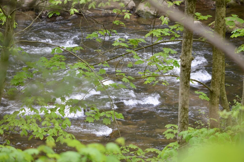
Any outdoors lover will have a superb time in the Ken Lockwood Gorge. You can park at either end of the gorge and take the easy out-and-back hike on the Ken Lockwood Gorge Trail which runs right next to the river. Another option is to combine the Ken Lockwood Gorge Trail and the Columbia/Highlands Trail to complete a 5-mile circuit hike (Here is a video of this 5-mile hike).
You will now be hiking on both the Highlands Trail and the Columbia Trail which is a very easy walk. On my hike, this is where the rain kicked in from an un-forecasted thunderstorm. I stopped and put my good camera in my daypack, secured my pack rain cover, and donned my rain gear as the downpour increased in its intensity. No amount of rain could take away from the incredible views of the river below.
For this hike, I was racing against the sunset in my goal to reach Long Valley. But as the pouring rain continued, I spotted a place of refuge.
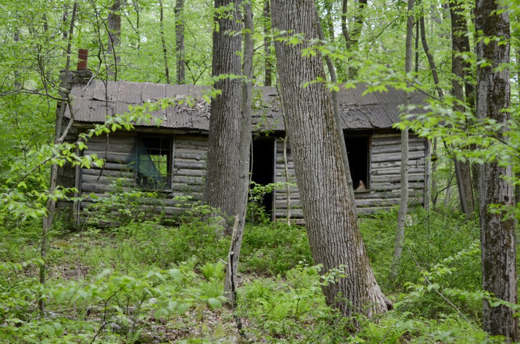
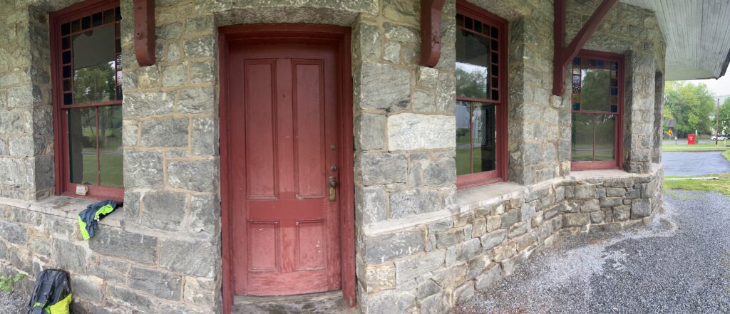
Califon’s Former Rail Station
A hiker will pass by more houses as the trail enters Califon, NJ. I noticed a biker who had taken a break at the former rail station on the side of the trail and followed his lead. This historic building has large overhangs and is the perfect place to ride out a storm!
With daylight fading and no Uber drivers willing to pick me up, I decided to walk back to my car and figured I would connect with my ride at some point on the way back.
To shorten the return trip, I hiked through the gorge on the Ken Lockwood Gorge Trail and then walked on the roads. A funny thing happened on this trip…I must not have communicated the actual plans and my ride didn’t realize that they were picking me up this evening. I kept walking and eventually made it back to my car after about 13 total miles. Another fun adventure with unexpected mileage at the end.
A video of this hike (NJ Highlands Trail – Hike 4)
This video summarizes the sights and terrain of NJ Highlands Trail – Hike 4 and includes footage of Spruce Run, Voorhees State Park, the South Branch Wildlife Management Area, and the Columbia Trail.
Click here to see Highlands Trail NJ – Hike 5: Hopefully, COMING SOON!
Click here to see Highlands Trail NJ – Hike 3: the previous section hike on the Highlands Trail.
For additional information, please visit the NY/NJ Trail Conference Website.
Highlands Trail NJ End-to-End Hike(s) Progress